I stopped by the North Carolina State Archives last week to see if I could find some more historic information on Rosengarten Park. In particular, I wanted to see if I could establish the date the land was originally purchased prior to its subdivision. I was helped by Larry, one of the archivists working there. First he helped me locate a microfilmed index of deeds by name. Searching under "Rosengarten" I found a list of properties purchased between 1909 & 1919..

Next, we went to another microfilm file cabinet and began looking up the deeds by book and page. I found one deed that I first thought was for Rosengarten Park, but later realized it was for a nearby property. I decided to make a copy of it anyway because I found one clause so interesting. The deed was for a property in the Boylan Heights area, immediately to the West of Rosengarten Park. It specifically prohibits occupancy by "negroes, or persons of mixed negro blood" It was not news to me that black families were prevented from living up the hill, but it is a little shocking to see such blatant racism written out in a legal document.

I searched each deed from oldest to youngest until I located this deed between Charles & Anita Holland and Alex Rosengarten. I found several things of interest in the deed. The first thing that struck me was that the deed was not signed but was transferred by a "mark" or "X" that the seller made on the document. A mark is ordinarily a cross or X made in substitution for the signature of an individual who is unable to write. More on marks at http://www.answers.com/topic/signature
The date of the deed is October 1914. The 1915 directory shows a number of residents living on Saunders, either indicating that they built the houses in that year, or that the houses were already there when he bought the land. The first recorded subdivision we could find was not recorded until 1919.
The date of the deed is October 1914. The 1915 directory shows a number of residents living on Saunders, either indicating that they built the houses in that year, or that the houses were already there when he bought the land. The first recorded subdivision we could find was not recorded until 1919.

Next, the reference to the Fourth Ward of Raleigh intrigued me. At home, I searched for information about the Fourth Ward and found that in 1875 Raleigh was.gerrymandered into 4 wards as 'an attempt to nullify the negro vote by isolating it within a portion of the city" Race, ethnicity, and urbanization: selected essays By Howard N. Rabinowitz The boundaries of the fourth ward
 Searching further for Fourth Ward of Raleigh, I also found that same year the ward was created, the Fourth Ward Republican Club, Of Raleigh sent a condolence letter to Mrs. Frederick Douglass, Anacostia, D. C. for the loss of her husband. "Resolved, That the wisdom and ability which he exercised during the twenty years preceding the war, through his own papers, the North Star, and the one bearing his own name, and in teaching from abolitionist platforms the great truth that a slave had a mind worth educating and fitting for liberty, did, with his efforts after the war, help to keep alive the idea that a colored man, whether free or slave, is capable of intellectual development, and moral and social progress. Resolved, That the sudden removal of such a life leaves a shadow on our hearts, and in the world a vacancy which will be deeply realized by all the liberty-loving people of this great country, and which will prove a serious loss to the public."
Next I searched the reference to "Rex Hospital Land" and found this excerpt in Sketches of the Early History of Raleigh
 "The 'field pines,'(old field pines spring up when farm fields are abandoned) a few years ago standing on Gallows Hill (Bloomsbury Condo's site) and the Rex Hospital Land....show that they were once cultivated fields, while the ravines opening into Pigeon House and Rocky Branches (the creek by Rosengarten Alley is a tributary to Rocky Branch creek) were for some time covered with beach and poplar of large growth" parenthesis mine The picture is of a Beech Tree.
  I had heard that the Bloomsbury Condo site used to be called Gallows Hill and that people had been hung there during the civil war. Searching 'Gallows Hill Raleigh" I found a picture of the old "Gallows Hill Bridge" which used to be located where the Boylan Bridge Pub is now.
http://www.legeros.com/vanished-raleigh/
 Then I found a reference to the hangings that took place there: "a beam was placed between two pines on Gallows Hill, ..The unfortunate wretch was seated on his own coffin in a cart..for some years the criminal was left in the cart, and after adjustment of the rope the horse was driven from beneath the beam" The early history of Raleigh
 While at the Vanished-Raleigh site, I also found this picture of the natural gas tank that used to be located at the right on Cabarrus in the PSNC site. I had heard about it before, but had never seen a picture. Notice how the frame for the tank is higher then the tank itself. I was told that the tank expanded and contracted maintaining a constant pressure while the amount of gas stored increased or decreased.
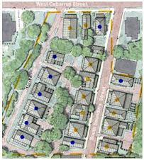
While still at the archive, I found a couple of maps that predate Rosengarten park, but show where it was eventually located. This map references Rex Hospital Land, and by comparing it to the next map, I was able to locate where Rosengarten site was on both maps. Note the creek that runs along Rosengarten Alley.


No comments:
Post a Comment